|


Browse or search 23595 items

|
Collectibles -> Transportation -> Maps & Atlases -> Maps -> US
|
 |
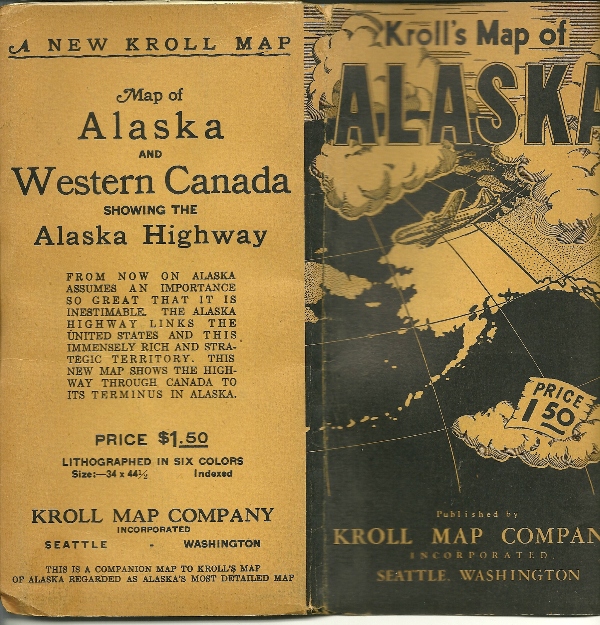
Alaska, Kroll's Map of 1940's
KROLL'S MAP OF ALASKA PUBLISHED BY KROLL MAP COMPANY SEATTLE,WASHINGTON, MAP OF ALASKA AND WESTERN CANADA SHOWING THE ALASKA HIGHWAY FROM NOW ON ALSKA ASSUMES AN IMPORTANCE SO GREAT THAT IT IS INESTIMABLE. THE ALASKA HIGHWAY LINKS THE US AND THIS IMMENSELY RICH AND STRATEGIC TERRITORY. THIS NEW MAP SHOWS THE HIGHWAY THROUGH CANADA TO ITS TERMINUS IN ALASKA
LITHOGRAPHED IN SIX COLORS SIZE: 34 X 44 1/2
FOLDED MAP IS 4 1/2" X 8 1/2" 12 PANELS FOLDED INTO QUARTERS
Item # : 132213
Box # : 82923
Shipping From: 1018 5th Ave Pittsburgh, PA 15219
Shipping Policy: See item description
Payments Accepted via: See Item Description
|
|


